
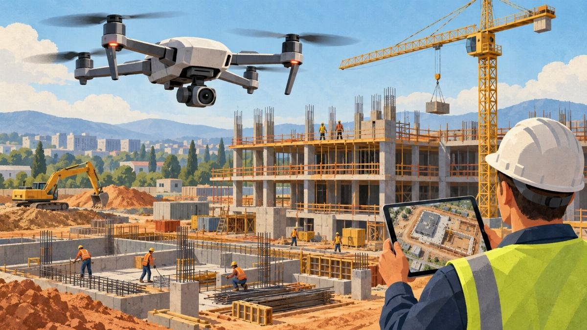
America’s built environment is getting bigger, older, and more complicated all at once. Buildings, highways, bridges, and construction sites are constantly changing, and much of that change never shows up in a walk-through from the ground. A roof can quietly deteriorate for years without any visible sign at street level. A sprawling construction site can contain dozens of separate work areas, each one evolving on its own schedule. Pavement can show one kind of distress while other problems stay hidden from view.
In a piece for American Thinker, Dania Akram argues that drones are adding another way to see what’s actually happening to that infrastructure — and that the real value lies in something more than pretty aerial photos.
A second set of eyes, not a replacement
Akram is direct about what drones are and aren’t. The technology, she writes, is not a substitute for engineers, inspectors, surveyors, or the other professionals who assess infrastructure. Instead, it functions as an additional source of visual and sensor-based information, especially in places that are hard or hazardous to reach.
The Federal Aviation Administration has documented the use of unmanned aircraft for infrastructure inspection, according to the piece, and the agency notes applications that include construction monitoring, highway inspection, bridge inspection, and pavement inspection. That documentation matters because it signals that the practice isn’t a novelty — it’s an established use case with a regulatory footprint behind it.
The distinction Akram draws is a careful one. Drones, in her framing, are most useful when they complement existing inspection methods rather than pretend to replace them. That may sound like a small caveat, but it’s the thread running through the entire argument.
Where drones actually help
Construction sites are the clearest example she offers. These projects generate an enormous amount of information, and while progress photos and site visits remain standard tools, a large site makes it genuinely difficult to maintain a consistent view of what has changed. When aerial imagery is collected systematically rather than sporadically, project teams can compare conditions over time and spot shifts that individual ground-level photos simply don’t capture.
Akram is careful here too. She notes that this documentation doesn’t determine whether construction is meeting every engineering or contractual requirement. It offers another layer of record-keeping — a way to help people understand what’s happening across a site that may be too large to read from any single vantage point.
Roofs present a different kind of problem. A commercial roof can cover thousands of square feet and include equipment, drainage systems, varying roof sections, and areas that are difficult to access. Examining every portion from ground level isn’t practical. A drone fitted with the right camera can capture detailed imagery of spots that would otherwise require someone to physically get up on the roof. The FAA has also documented drone applications involving roof inspection and thermal imagery, the piece notes.
For property owners and facility managers, that kind of inspection can provide another way to document roof conditions and flag areas that may warrant closer examination — a mechanism for deciding where human attention should be spent, rather than a verdict in itself.
What a thermal image can’t tell you
Specialized sensors extend what drones can observe. Thermal cameras capture differences in surface temperature that ordinary photographs miss entirely. That information can be useful as part of an investigation — but, as Akram stresses, it still requires appropriate interpretation. A thermal image, on its own, is not a diagnosis of a building problem.
The same logic applies to roads and other large surfaces. The FAA has researched the use of small unmanned aircraft for pavement inspections and developed repeatable processes for collecting and analyzing aerial data, according to the piece. Aerial imagery can give a broader view of pavement and similar surfaces, while specialized ground-based methods remain essential for the questions photographs alone can’t answer.
That division of labor is the point. The technology tells you where to look. It doesn’t always tell you what you’re seeing.
The real prize: a record over time
Perhaps the most useful contribution of aerial technology, Akram suggests, isn’t the ability to take pictures from above at all — it’s the ability to build a record.
A single photograph captures a condition at one moment. Consistent imagery collected throughout a construction project or across repeated inspections shows how conditions change. For property owners, construction professionals, engineers, and infrastructure managers, that historical record can make it easier to communicate changes to others and to figure out where closer investigation is necessary.
In other words, the value compounds. One flight is an observation. A series of flights is a dataset — and datasets are what let people spot trends, back up their judgments, and build a shared picture of a structure’s health over months and years.
The rules still apply
None of this happens in a vacuum. Drone operations must comply with applicable aviation requirements, and some locations carry additional restrictions. Akram points to earlier American Thinker coverage examining the regulatory challenges surrounding commercial drone use in infrastructure inspection. Under the FAA’s current Part 107 rules, many small-drone operations face established requirements, while certain sensitive and critical infrastructure locations can be subject to extra restrictions.
Those constraints shape where and how the technology can realistically be deployed. They’re also part of why the piece resists the temptation to declare a revolution. Regulation, not capability, often determines what can be flown, where, and under what conditions.
The bigger picture
The conclusion Akram reaches is deliberately modest: drones don’t make traditional inspection obsolete. They simply mean infrastructure can be observed in more ways than before.
That framing lands against a backdrop of an American built environment that is, by her description, growing larger, older, and more complex. Better observation, she argues, can become a practical component of better maintenance. Drones offer one additional set of eyes — capable of reaching perspectives that are difficult to obtain from the ground.
It’s a case built on addition rather than replacement. The inspectors, engineers, and surveyors stay. The drones just give them more to work with.
Source: www.americanthinker.com — https://www.americanthinker.com/blog/2026/09/what-drones-can-reveal-about-america-s-built-infrastructure/